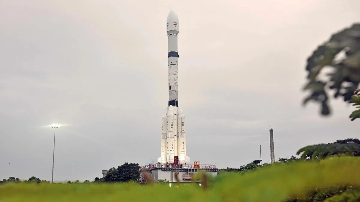
📍 Sriharikota, India – July 30, 2025
In a historic milestone for global Earth observation, the NASA-ISRO Synthetic Aperture Radar (NISAR) satellite was successfully launched today on the GSLV-F16 rocket from the Satish Dhawan Space Centre in Sriharikota, Andhra Pradesh.
This $1.5 billion joint mission between the Indian Space Research Organisation (ISRO) and the U.S. National Aeronautics and Space Administration (NASA) marks the most expensive Earth observation satellite ever launched, underlining its advanced capabilities and critical role in understanding our planet.
🚀 First GSLV to Reach Sun-Synchronous Orbit
The Geosynchronous Satellite Launch Vehicle (GSLV-F16) placed the 2,392 kg NISAR satellite into a Sun-synchronous polar orbit at 740 km altitude.
- This is the first time a GSLV rocket has launched a satellite into a Sun-synchronous polar orbit—expanding ISRO’s technical versatility beyond geosynchronous missions.
- The flawless launch also enhances India’s reputation as a reliable provider of advanced satellite launch services.
📡 What Makes NISAR Unique?
1️⃣ Dual-Frequency Radar:
- NISAR is the first Earth observation satellite to combine NASA’s L-band and ISRO’s S-band Synthetic Aperture Radar (SAR) systems.
- This enables it to penetrate clouds, vegetation, and darkness, allowing all-weather, 24/7 observations.
2️⃣ Global Coverage Every 12 Days:
- NISAR will map the entire land and ice-covered surfaces of the planet every 12 days, detecting surface changes as small as 1 centimeter.
3️⃣ Open Access Data:
- All imagery and measurements from NISAR will be freely available to scientists, governments, and the public worldwide, democratizing access to critical Earth data.
🌐 Why NISAR is a Game-Changer
🌋 Disaster Management:
- Early detection and response for earthquakes, landslides, floods, and volcanic eruptions, enabling life-saving evacuation planning.
🌡️ Climate Monitoring:
- Tracking glacial melt, sea-level rise, soil moisture, and permafrost degradation, feeding into climate models for better predictions.
🌱 Agriculture & Food Security:
- Monitoring crop health, irrigation levels, and land-use changes for more accurate forecasts and resource management.
🌳 Ecosystem Studies:
- Measuring woody biomass and wetland health, aiding global efforts in forest conservation and biodiversity protection.